Brief Overview:
- Rising tropical cyclone surf for Sunday into early next week
- Track and intensity of yet-to-develop cyclone key for determining best surf Sun-Tue
- Prolonged run of medium-sized surf likely for rest of Olympic window (through August 1)
Please note the surf size below is given in face height.
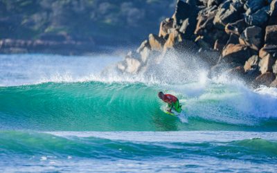
SUNDAY 25th: Rising 3-4’ becoming 4-6’ (0.9m-1.2m becoming 1.2m-1.8m) SE/ESE swell and northeast windswell mix. Increasing onshore winds.SWELL/SURF: Waist- to chest-high SE/ESE swell and developing NE windswell builds into the head-high range with overhead peaks. Conditions deteriorate, becoming choppy as the onshore winds increase. Large tidal swings with midday low tide.
WIND: Onshore NE at 10-15kts increasing to 15-20kts over the afternoon.
MONDAY 26th: 6-8’ (1.8m-2.4m) E/ENE swell. Breezy NE/N trending NW to W winds allow for improving conditions.SWELL/SURF: Solid head-high to overhead E swell and windswell mix. Conditions start off sideshore and jumbled but look to improve over the afternoon. Large tidal swings with midday low tide.
WIND: NNE to N at 15-20kts trending NW to W and easing some over the afternoon.
TUESDAY 27th: 4’ occasional 5’ (1.2m occasional 1.5m) ENE/SE swell mix. Moderate+ SW trending SSW winds.SWELL/SURF: Peaky swell mix in the chest-high range with head-high sets. The surf is a bit smaller around the low tide. Clean conditions through the morning becoming more side-offshore textured in the afternoon. Large tidal swings with early PM low tide.
WIND: SW trending SSW winds 12-17kts.
WEDNESDAY 28th: 4’ occasional 5’ (1.2m occasional 1.5m) SE/ESE swell mix. Moderate SW trending SSW winds.SWELL/SURF: Swell mix holds in the chest-high range with head-high sets. The surf is a bit smaller around the low tide. Clean conditions through the morning becoming more side-offshore textured in the afternoon. Large tidal swings with early PM low tide.
WIND: SW trending SSW winds 12-17kts.
Stream Live: Shidashita Multi-Cam
Swell/Surf Outlook
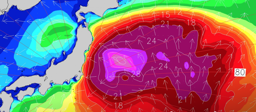
A tropical cyclone is expected to form in the next 24-48 hours around 700nm (1300km) south of Shidashita, before tracking northward over the weekend. We expect SE/ESE swell generated by the tropical system, which will be named Nepartak, to fill in on Sunday, July 25th, biggest late in the day. As the system approaches we should see our winds increase, resulting in deteriorating conditions throughout the day.
The outlook for early next week depends on the track and strength of the tropical cyclone and we’ve seen subtle but important shifts in the guidance since yesterday’s update. Ideally, the system would stay offshore or pass well to our north as those tracks would result in improving conditions early next week. In contrast, if the system passes to our south we’d see solid surf but onshore winds. For continuity, we will stick with the idea that the system passes to our north, but note that if subsequent data suggests a more southerly track is likely we’ll need to adjust our wind and condition outlooks for Monday and Tuesday. Stay tuned.
A favourable pattern sets up behind the tropical system that impacts the area to start the contest window, producing a multi-day run of contestable surf for the second half of next week into next weekend. There are indications we may see another tropical system try to spin up in our swell window during that time frame which would further enhance the potential surf size. We’ll monitor that and nail down the wind forecast for the remainder of the competition in the coming days.
Participation

My Profile
Login to your profile or Sign up to our new Surfing Portal.
Memberships
Head to your Surfing Portal to purchase or renew memberships

Events & Courses
Head to your Surfing Portal to enter events and courses.
